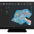
(IN BRIEF) Leica Geosystems has acquired Scasa, the company behind the PinPoint 3D modelling software, expanding its reality capture portfolio. PinPoint offers users intuitive tools for point cloud registration, meshing, and modelling, making it easier to create floorplans, orthoimages, and … Read the full press release →
Posted in Business, Financial, Government, Industrial, Infrastructure & Utilities, Investment, Management, Marketing, News, Sweden, Switzerland, Technology
Tagged 3D modelling, BIM, CAD, floorplans, geospatial technologies, Hexagon, Leica BLK360 SE Essentials, Leica Geosystems, meshing, orthoimages, partnership, PinPoint, point cloud registration, reality capture, Scasa, Simon Mark, software acquisition, strategic innovation